No Warning, Advisory or Watch is in effect for Puerto Rico and the Virgin Islands.

No Warning, Advisory or Watch is in effect for Puerto Rico and the Virgin Islands.
In the Puerto Rico Seismic Network (PRSN), digital and analog records (seismograms) are processed. The first step, before starting the processing of the seismic data, is to identify in the records all the seismic events that occur daily. Once the earthcuakes are identified, the following step is to determine if the earthquake is LOCAL, REGIONAL (MIDAS) or TELESISMIC. Once determined the type of earthquake we proceed to locate it, all those earthquakes that the PRSN registers, processes and locates are local or regional earthquakes nearby. To process the earthquakes a program developed in the PRSN is used and that uses the program of localization HYPO 2000 as well. This processing program is PRSN Data Analisys and Information System, better known as PRDANIS. The magnitudes of the seismic events are calculated using the maximum amplitude (XMAG) and the duration time or CODA (FMAG) registered by each station, according to Eaton's formula (1994), and using the velocity model proposed by Orphan and Bataille (1994). On the other hand, all earthquakes that PRSN records but cannot locate are processed using the location of the National Earthquake Information Center of the United States Geological Survey (NEIC-USGS) as a basis. These are usually faraway regional earthquakes or faraway earthquakes also known as teleshocks.
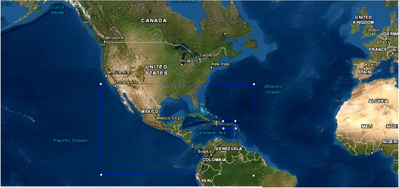
All earthquakes located within latitudes 17.0° N - 20.0° N and longitudes 63.5° W - 69.0° W are considered local earthquakes. To determine the location of the seismic event, the arrival times of the P and S waves, the polarity of the waves, as well as the quality of these readings are required. To calculate the magnitude it is necessary to read the duration (CODA) and the maximum amplitude of the seismic wave for each station that recorded the event.
            YEAR MO DA  --ORIGIN--  --LAT N-  --LON W--  DEPTH   RMS   ERH   ERZ  XMAG  FMAG  PMAG  INT
            2004-08-22  0009 19.79  18 42.77   68 25.69 179.95  0.24  5.75  2.16  3.84  3.60  3.60D
                                                                                                    SOURCE
            NSTA NPHS  DMIN MODEL GAP ITR NFM NWR NWS NVR REMRKS-AVH  N.XMG-XMMAD-T   N.FMG-FMMAD-T  L F X
              15   19 141.6  PR1  347  12   8  18  11  19     Q  PPG   5.00  0.07      7.00  0.02 D

            XMAG2-N.XMG2-XMMAD-T-S  FMAG2-N.FMG2-FMMAD-T-S  PREF.MAG-N.PMAG-PRMAD-T
            3.84   5.00  0.07 L     3.60   7.00  0.02 Z        3.60   7.00  0.02 D

            REGION= Eastern Dominican Republic

            STA NET COM CR DIST AZM  AN P/S WT   SEC (TOBS -TCAL -DLY  =RES)  WT   SR  INFO  CAL DUR-W-FMAG-T -AMP-U-PER-W-XMAG-T
            AGPR PR HHE  A141.6 100 140 ES  1  73.04 53.25 53.26 0.00 -0.01  1.06S    0.519
            AGPR PR HHZ  A141.6 100 140 EP+ 1  49.87 30.08 29.92 0.00  0.16  1.06     0.265 0.73  72   3.60 Z
            LSP  PR SHE  A153.8 112 138 ES  1  74.81 55.02 55.04 0.00 -0.02  1.06S    0.365
            LSP  PR SHZ  A153.8 112 138 EP+ 1  49.87 30.08 30.92 0.00 -0.84* 0.48     0.055 1.40  95   3.58 Z    62C1.00   4.04 L
            LRS  PR SHZ  A173.6 105 134 EP+ 1  52.35 32.56 32.64 0.00 -0.08  1.06     0.184 1.40  87   3.52 Z    43C1.00   3.94 L
                                        ES  1  78.00 58.21 58.10 0.00  0.11  1.06S    0.149
            AOPR PR HHN  A181.4 102 133 ES  1  79.07 59.28 59.35 0.00 -0.07  1.06S    0.177
            AOPR PR HHZ  A181.4 102 133 EP+ 1  53.24 33.45 33.34 0.00  0.11  1.06     0.185 0.73  72   3.64 Z    133C1.00   3.84 L
            PORP PR SHZ  A202.6 110 130 EP+ 1  54.31 34.52 35.34 0.00 -0.82* 0.58     0.077 1.40  82   3.50 Z
                                        ES  1  82.60 62.81 62.91 0.00 -0.10  1.06S    0.251
            CELP PR SHZ  A207.8 109 129 EP+ 1  55.73 35.94 35.84 0.00  0.10  1.06     0.242 1.40  91   3.60 Z    23C1.00   3.78 L
                                        ES  1  83.65 63.86 63.80 0.00  0.06  1.06S    0.207
            CSB  PR SHZ  A244.4 100 125 ES  1  89.98 70.19 70.35 0.00 -0.16  1.06S    0.204
            SJG  IU BHN  A249.8 105 124 ES  1  90.88 71.09 71.34 0.00 -0.25  1.06S    0.159
            SJG  PR SHZ  A249.8 105 124 EP+ 1  61.50 41.71 40.09 0.00  1.62* 0.00     0.000 1.40  87   3.61 Z    17C1.00   3.77 L
                                        ES  1  91.73 71.94 71.36 0.00  0.58* 1.06S    0.159
            CBYP PR HGZ  A276.0  99 121 EP+ 1  62.71 42.92 42.86 0.00  0.06  1.06     0.267 0.73  89
            CBYP PR HGN  A276.0  99 121 ES  1  96.06 76.27 76.29 0.00 -0.02  1.06S    0.304
            HUMP PR HGN  A279.8 102 121 ES  1  96.52 76.73 77.02 0.00 -0.29  1.06S    0.222
For events that were not digitally recorded, the P and S arrival times, as well as the CODA and amplitude, are read directly from the seismograms. After these data have been pre-located, the residual errors of each reading, the rms and the vertical (erz) and horizontal (erh) errors are checked. If necessary, the seismogram is reread and the event is relocated. This process is repeated until the best possible location is reached. Once all these steps have been completed, the processing of the seismic is finished, and its location is integrated to our seismic data base, which can be accessed through this page. Our data is used to complement the seismic databases of other networks and is sent to the service lists. The seismic data processed by RSPR is used for research by local and international institutions.
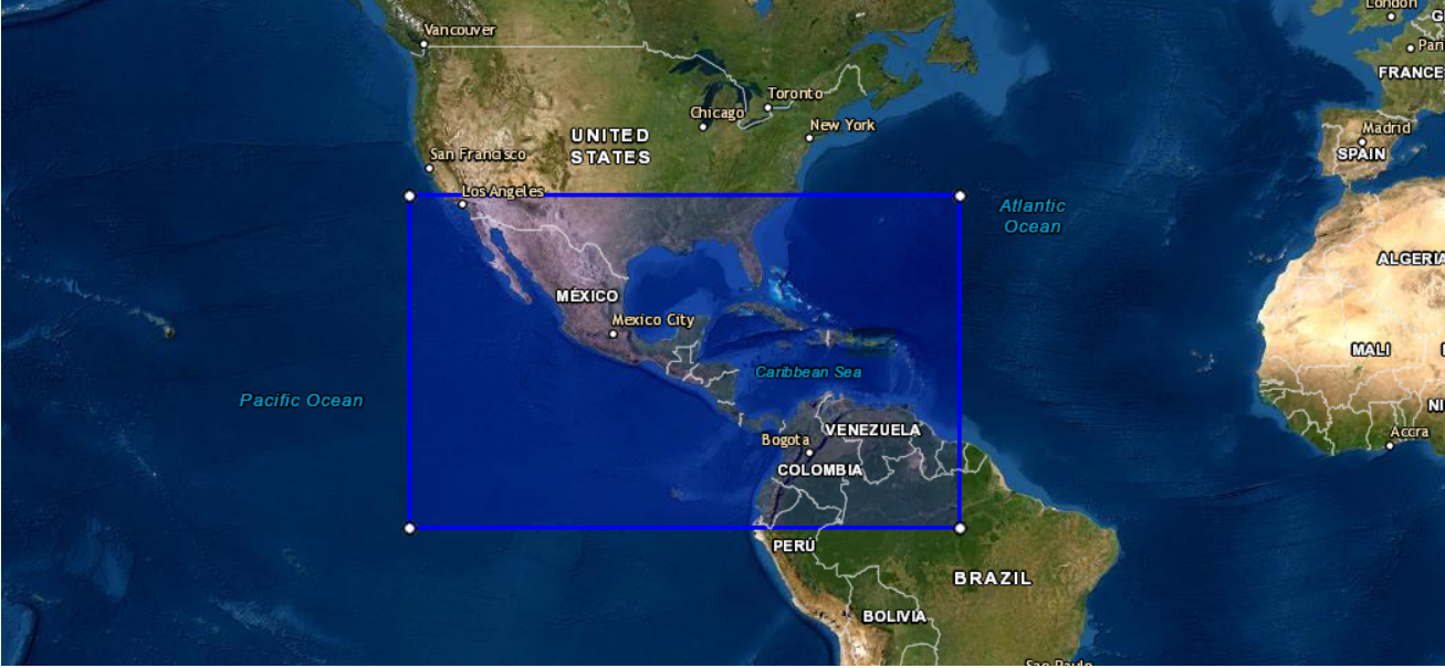
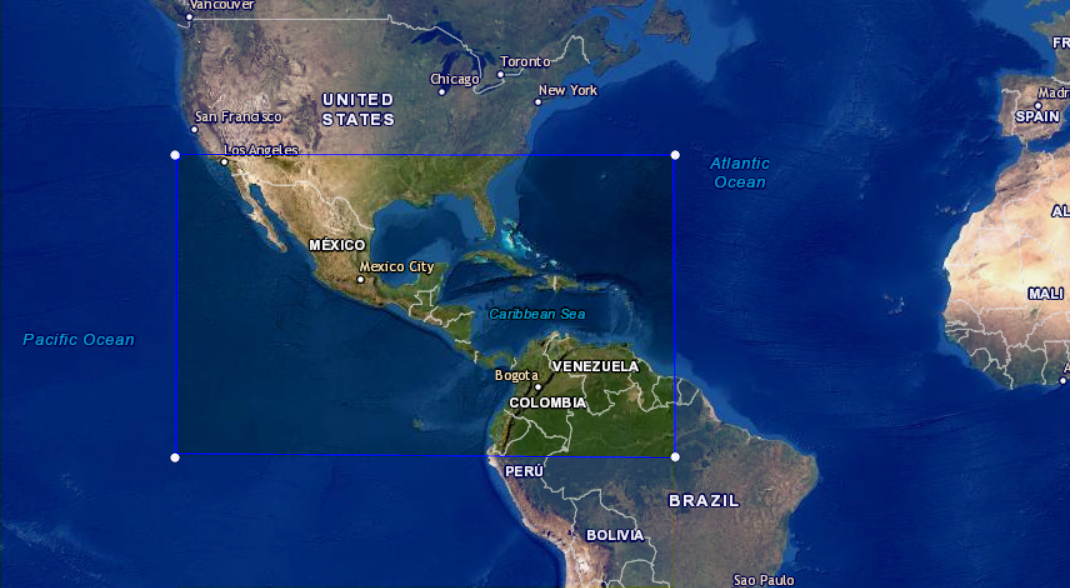
Those earthquakes whose epicenters are located outside the local area, known as the Puerto Rico and Virgin Islands Region, (latitudes 17.0° N - 20.0° N and longitudes 63.5° W - 69.0° W) and within latitudes 5.0° S - 35.0° N and longitudes 55.0° W - 125.0° W are considered regional earthquakes (MIDAS region).
There are three different processes for regional events:
          YEAR MO DA  --ORIGIN--  --LAT N-  --LON W--  DEPTH   RMS   ERH   ERZ  XMAG  FMAG  PMAG  INT
          2004-08-23  1435 34.77  20 22.89   70 35.70  25.00  0.82 21.33 69.06  4.80  4.41  4.41D
                                                                                                  SOURCE
          NSTA NPHS  DMIN MODEL GAP ITR NFM NWR NWS NVR REMRKS-AVH  N.XMG-XMMAD-T   N.FMG-FMMAD-T  L F X
            20   23 396.2  PR1  351  17  11  21  11  23     Q- PPG   6.00  0.10      8.00  0.13 D

          XMAG2-N.XMG2-XMMAD-T-S  FMAG2-N.FMG2-FMMAD-T-S  PREF.MAG-N.PMAG-PRMAD-T
          4.82   5.00  0.09 L     4.41   8.00  0.13 Z        4.41   8.00  0.13 D

          REGION= Out of Puerto Rico/Virgin Islands

          STA NET COM CR DIST AZM  AN P/S WT   SEC (TOBS -TCAL -DLY  =RES)  WT   SR  INFO  CAL DUR-W-FMAG-T -AMP-U-PER-W-XMAG-T
          IDE  PR SHZ  A396.2 123  90 EP+ 1  86.40 51.63 52.22 0.00 -0.59* 1.00     0.247 1.40 182   4.16 Z   127C1.00   4.93 L
          IDE  PR SHE  A396.2 123  90 ES  1 131.49 96.72 92.95 0.00  3.77* 0.00S    0.102
          AGPR PR HHZ  A423.0 119  90 EP+ 1  96.67 61.90 55.61 0.00  6.29* 0.00     0.000 0.73 163   4.39 Z
          AGPR PR HHE  A423.0 119  90 ES  1 134.95100.18 98.99 0.00  1.19* 1.00S    0.166
          LSP  PR SHZ  A442.6 122  90 EP+ 1  93.60 58.83 58.09 0.00  0.74* 1.00     0.373 1.40 188   4.27 Z
          LSP  PR SHE  A442.6 122  90 ES  1 137.09102.32103.40 0.00 -1.08* 1.00S    0.867
          LRS  PR SHZ  A457.2 119  90 EP+ 1  94.76 59.99 59.95 0.00  0.04  1.00     0.109 1.40 188   4.29 Z
                                      ES  1 140.71105.94106.71 0.00 -0.77* 1.00S    0.166
          AOPR PR HHZ  A462.4 118  90 EP+ 1  96.43 61.66 60.61 0.00  1.05* 1.00     0.102 0.73 175   4.52 Z   252C1.00   4.77 L
          AOPR PR HHE  A462.4 118  90 ES  1 144.26109.49107.89 0.00  1.60* 1.00S    0.120
          CSB  PR SHZ  A521.0 115  90 EP+ 1 102.35 67.58 68.02 0.00 -0.44  1.00     0.131 1.40 192   4.42 Z   113C1.00   5.18 L
                                      ES  1 156.69121.92121.08 0.00  0.84* 1.00S    0.136
          SJG  IU BHE  A531.0 117  90 ES  1 156.65121.88123.34 0.00 -1.46* 1.00S    0.099
          SJG  PR SHZ  A531.1 117  90 EP+ 1 104.46 69.69 69.30 0.00  0.39  1.00     0.103 1.40                 48C1.00   4.82 L
                                      ES  1 157.92123.15123.35 0.00 -0.20  1.00S    0.099
          CBYP PR HGZ  A550.5 114  90 EP+ 1 106.08 71.31 71.75 0.00 -0.44  1.00     0.157 0.73 193
          CBYP PR HHE  A550.5 114  90 ES  1 162.92128.15127.71 0.00  0.43  1.00S    0.193 0.73                148C1.00   4.73 L
          CPD  PR BHZ  A556.9 117  90 EP+ 1 107.20 72.43 72.56 0.00 -0.13  1.00     0.103 0.73 204   4.82 Z
          CPD  PR BHE  A556.9 117  90 ES  1 163.51128.74129.16 0.00 -0.42  1.00S    0.099
          HUMP PR HGZ  A557.7 115  90 EP- 1 107.23 72.46 72.66 0.00 -0.20  1.00     0.131 0.73 213
          HUMP PR HGE  A557.7 115  90 ES  1 162.82128.05129.33 0.00 -1.28* 1.00S    0.136 0.73                173C1.00   3.52
          MTP  PR BHZ  A588.0 114  90 EP+ 1 110.79 76.02 76.50 0.00 -0.48  1.00     0.157 0.73 291   5.20 Z
          MTP  PR BHE  A588.0 114  90 ES  1 171.80137.03136.17 0.00  0.86* 1.00S    0.193
            SOURCE:             NEIC
            DATE (yyyy/mm/dd):  2004/08/22
            TIME (hh:mm:ss.ss): 04:54:08.90
            LATITUDE:           9.351
            LONGITUDE:          -78.513
            DEPTH:              75.3
            REGION:             Panamá
            Mw:                 0.0
            Mb:                 4.6
            Ms:                 0.0
            Ml:                 0.0
            QUAKE STATIONS:     109
            RSPR PHASES: 4
For the Telesismatic earthquakes (outside the latitudes 5.0° S - 35.0° N and the longitudes 55.0° W - 125.0° W) a record of the waveforms that contain the earthquake, the times of arrival and their location is kept (carried out by the NEIC-USGS or another world-wide network). To complete the processing of the far away earthquakes, the times of the first arrival of the wave, the polarity of these, as well as the quality of these readings are required for each station that has registered the earthquake. These data are integrated into the PRSN database with the NEIC-USGS locations or solutions.
          SOURCE:             NEIC
          DATE (yyyy/mm/dd):  2004/08/07
          TIME (hh:mm:ss.ss): 09:30:16.45
          LATITUDE:           51.814
          LONGITUDE:          -66.464
          DEPTH:              10.0
          REGION:             South of the Aleutian Island
          Mw:                 6.0
          Mb:                 6.3
          Ms:                 5.4
          Ml:                 0.0
          QUAKE STATIONS:     180
          RSPR PHASES: 13